

All Around Was Thunder and Lightning: A Survey of the Revolutionary War’s Underwater Battlefield at Yorktown
In 2023 the Commonwealth of Virginia was awarded funding from the National Park Service (NPS) Semiquincentennial Grant Program to conduct a comprehensive archaeological survey of the maritime battlefield of the Siege of Yorktown, the last major battle in the American Revolutionary War (1775-1783). Administered by the Virginia Department of Historic Resources (DHR), the funds allowed underwater archaeologists to continue the investigation of the site that began in the late 1970s through 1980s. Below, DHR’s state underwater archaeologist discusses the significance of the 1781 Siege of Yorktown maritime battle and how archaeologists’ quest to find the cultural resources left behind in the river shapes the way we think about the American Revolution on the nation’s 250th Anniversary.
By Brendan Burke | DHR State Underwater Archaeologist
On the evening of October 10, 1781, the York River was a perfect hell. For British forces at Yorktown, the previous fortnight revealed a grim reality of siege warfare. Each day, trenches dug by Patriot and French forces inched closer. A slowly tightening noose formed around King George’s army; critical supplies were cut off. French naval forces lurked downstream in the York River, bottling up a flotilla of British army transports and a Royal Navy contingent at Yorktown. With nowhere to escape, the desperate fleet decided to live out its final days by fighting to the bitter end. Most of the British supply ships were sunk along the waterline, acting as a wooden fortress along the waterfront to prevent an amphibious assault. HMS Charon, a 44-gun frigate, and HMS Guadeloupe, a Coventry-class 28-gun frigate, were the most advanced British naval contingent at Yorktown—and the only vessels in the flotilla with their hulls covered in copper to protect from shipworms. Trapped, their batteries were moved ashore in September and only a few cannons were left aboard for defensive fire. Deprived of commanding firepower, the two warships emptied their magazines into French and American lines as a pitiful retaliation against a massive Allied bombardment.
After several weeks of siege warfare that included probing infantry assaults, sustained artillery fire, and the depletion of supplies, mid-October brought a culminating crescendo. Thousands of French and Continental artillery projectiles pounded the ground around Yorktown. A Hessian soldier called it a ‘stupendous cannonading’. British forces were pounded flat, almost unable to respond. Charon and Guadeloupe’s provided paltry counterbattery fire. Royal dominion over the Old Dominion had never been more threatened.
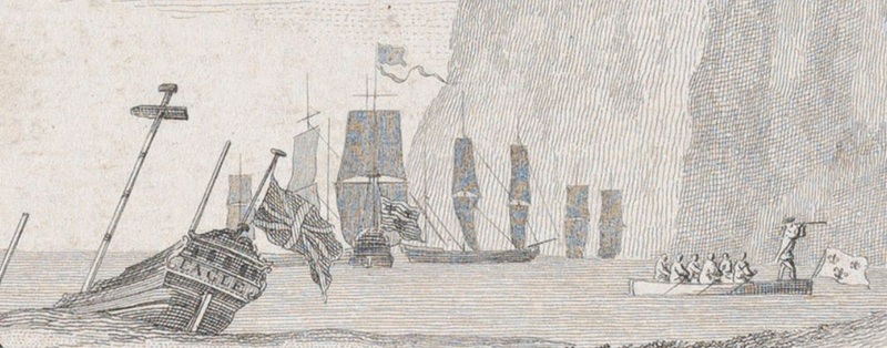
At about 3:30 on the afternoon of October 10, 1781, a red-hot cannonball hit Charon’s weather deck so hard it stuck in the planks. Wood around the impacted area began to burn, but quick-thinking sailors dislodged the shot and tossed it into a bucket of water. Almost immediately, a second hot shot hit Charon’s hull and lodged inside the sail room. Sizzling, the glowing cannonball ignited everything it touched. A growing conflagration of canvas and wood choked the men and drove them upwards, gasping for air. Amongst the din of the shoreside battle, HMS Charon’s deck grew hotter as the fire belowdecks became a raging inferno. Her crew lost control, and now, Charon was adrift with wind and tide, a blazing chimera spreading fire to other British vessels. According to the ship’s carpenter, “Everything that was in the Power of men; Nothing more could be done.”
Men afloat and ashore witnessed the beginning of the end overnight and through the day of October 11. Surviving ships were ‘miserably ruined and shot to pieces’. So great was the fire that single cannonballs passed through two vessels before skipping to a halt on the river. HMS Guadeloupe retreated to the north shore, as far as she could go without fleeing the scene. From her vantage at Gloucester Point, the scene was horrendous. Broken masts and spars jutted from the water along the Yorktown shoreline. On October 13, HMS Fowey’s sailors bored holes in her starboard bow and the ship was sunk by its own hands. Guadeloupe received orders to scuttle two days later. Sails removed from the ships that were condemned to the deep were used to make tents for wounded troops ashore. The scene there was just as desperate. Horses and mules for whom the British Army had no fodder were shot and dragged into the river. Without them, even the prospects of moving the British army became near impossible. Surviving vessels afloat in the York were in a sea of dismay, decay, and disaster. An attempt by Cornwallis to escape through the river was prevented by a sudden squall. Even the heavens seemed to be against him. Banastre Tarleton, the blustery commander of British dragoons, wrote, “Thus expired the last hope of the British army.” To the beating of a lone drum on October 18, a white flag waved over the British parapets. Cornwallis’s capitulation ended five years of bloody combat that was as much a world war as a revolution.
Today, the battlefields at Yorktown are marked by National Park Service interpretive signage, reconstructed earthworks, and museums. Visitors stroll where soldiers huddled, charged, and died. Post-war farming of the battlefield, more battle during the Civil War, and development all turned the soil at Yorktown, disturbing much of the archaeological footprint. Within the York River, sunken ships from the American Revolution remain, captured now by anerobic mud, sand, and broken shell. Explorations during the 1930s proved that these wrecks contained some of the most intact features of the 1781 siege. Work by the Institute for Nautical Archaeology (INA) during the 1970s brought systematic archaeology to the underwater landscape for the first time. Intensive fieldwork led by Dr. John Broadwater and the Virginia Department of Historic Resources (DHR) during the 1980s marked a pivotal moment in the field of maritime archaeology and American history. Visitors to the Yorktown Shipwrecks Archaeological Project (YSAP) watched divers carefully excavate the transport Betsy inside a steel-clad laboratory.
Today, the Semiquincentennial anniversary of the American Revolution offers an opportunity to reflect on the sacrifices, achievements, and determination of Virginia’s patriots. It also offers a chance to reinvestigate who we were as a colonial Virginia, and how that enterprise disintegrated in revolution. There were few clear paths to our forebears, and no certain outcomes. For us, exploring battlefields of the American Revolution is an introspective journey into the formation of the United States, and how we each continue to shape its course. British vessels lying within the bottom of the York River are some of the most intact elements of our revolution. They are silent wooden markers to the culminating battle of the war, and the beginning of the struggle to form a more perfect union.
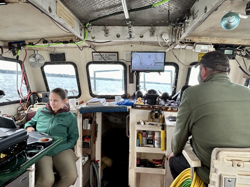
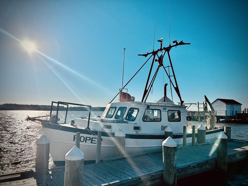
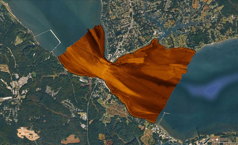
In 2022, DHR recognized the need to revisit the York River at Yorktown as part of our homage to the 250th anniversary of our founding. Thanks to funding from the National Park Service’s Semiquincentennial Grant Program and the Commonwealth of Virginia, DHR conducted a comprehensive survey of the York River, within the National Register boundary, in 2024 and 2025. Phased as deep water and shallow water survey areas, this survey complimented a 1978 survey of the York River to locate wrecks studied as part of the YSAP project. What archaeologists then, and now, know, is that many sunken vessels from the Siege of Yorktown remain at large. A row of wrecks identified along the Yorktown shoreline, invisible to beachgoers but nonetheless present, comprise only a few of the massive tonnage that was lost in the river in 1781. There are other historic mysteries within the York, such as a paddlewheel from the steamer Kennebec, lost in 1870. The most recent survey sought to update our knowledge of the river bottom and take a ‘big picture’ of the underwater scene.
After many tireless miles of survey pulling a sonar and magnetometer, the survey team was able to plot out hundreds of magnetic and acoustic targets. From the noise of data, refinement reduces the anomalies to a concise list of targets. One new wreck, never before mapped, was found on the north side of the river and remains to be identified. More buried, or partially buried, acoustic and magnetic targets were identified and patiently await diver investigation. Modern science is a wonderful thing, but nothing replaces putting a scientific diver on a target location to separate shipwreck from debris.
Archaeologists, like anyone, want an easy home run, but winning the World Series is never based on luck. The new data set will drive a renewed effort to locate unidentified wrecks that may turn out to be lost ships from 1781. Additionally, there are areas downriver where British fireships were set free to burn their way through the French fleet, which held them hostage in the York. Those wrecks remain at large, and, as a sidebar to the battle, are just as important as any artifact from the war on land.
The results of this survey are an important part of resource stewardship. Sonar and magnetic data provide a record of the river bottom that captures a snapshot in time. We have identified areas more prone to scouring from river current, areas more prone to disturbance from shoreline development, and are able to plan future research accordingly. The river bottom, like any submerged bottomland in Virginia, is a public resource held in public trust. Archaeological sites from the American Revolution are a nonrenewable resource. They contain answers to questions we may not yet have. Learning from underwater sites, whether from remote sensing data, excavation, or doing documentary research to provide additional context, is exciting work.
If you get a chance to visit Yorktown, stand on the banks of the river. Close your eyes, and imagine the scene described here. Open your eyes, and see HMS Charon ablaze; hear thudding cannonballs striking all around; and feel the epic final struggle to rid Virginia of a tyrant king. That was the serious business of a revolution, and it left behind a trail of artifacts that represents the fog of war. The Revolution was a cataclysm of colonies becoming states, struggling to unite for the pursuit of liberty. Shipwrecks and their artifacts at Yorktown bore witness to this scene and still speak to us through archaeological inquiry. Perhaps some of Yorktown’s artifacts remind us of our shared obligation to try to find the best path forward. Such is the value of archaeology.
Acknowledgements
DHR would like to thank the National Park Service Semiquincentennial Grant Program for funding Phase I research in the York River. Seafloor Solutions, LLC., and the Institute of Maritime History also provided valuable services to accomplish the goals of the project. Additionally, the author would like to thank Dr. John Broadwater, John Sands, Josh Daniel, David Howe, Dan Lynberg, and the Virginia Institute for Marine Sciences for their dedication to the maritime history of the York River.
Legal Disclaimer:
EIN Presswire provides this news content "as is" without warranty of any kind. We do not accept any responsibility or liability for the accuracy, content, images, videos, licenses, completeness, legality, or reliability of the information contained in this article. If you have any complaints or copyright issues related to this article, kindly contact the author above.
